
 Resources on this page are licensed under a Creative Commons Attribution-NonCommercial-NoDerivatives 4.0 International License
This tutorial is an addendum to the introductory GIS Practicum; it focuses on working with raster data in QGIS with an emphasis on elevation models and includes: downloading, tiling, and warping (re-projecting) DEMs and DRGs and creating hillshades and contour lines.
Anyone is welcome to use this tutorial for personal or classroom use under a Creative Commons BY-NC-ND license. However, you may not copy and re-host this material on another website.
Working with Raster Data in QGIS 2nd edition (Dec 2015) 1st edition (June 2014) | 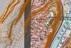 |
QGIS Software for Download
The 2nd edition of the tutorial was updated for QGIS version 2.8 (Wien). It contains the same material from the 1st edition, plus a new chapter on clipping a raster using a vector file. The 1st edition was written for QGIS version 2.4 (Chugiak); instructions for both editions should work in all 2.x versions of QGIS. The most recent version of the software can be downloaded from the The QGIS website.