
...
The datasets on this page were produced by the GIS Lab at the Newman Library of Baruch College, CUNY using the Data Feeds from the Metropolitan Transportation Authority (MTA) and the GIS files from the NJ Office of Information Technology. They represent NYC transit bus, rail, and subway routes and stops. It was created so that members of the public would have access to well-documented and readily-usable GIS layers of NYC mass transit features. The point and line layers are in a shapefile format, projected in NAD 83 NY State Plane Long Island (feet). The route files for the subway and the railroads include style files for QGIS (.qml) and ArcGIS (.lyr).
Please review the metadata for a description of the contents, creation, and use limitations of the shapefiles. Read this post for pointers on applying colors and styles. The data is intended for non-commercial use for basic geographic analysis and mapping purposes, and will be updated bi-annually. This page contains the most recent version of the data (May 2016)versions of the data. Some layers are not updated bi-annually because there were no changes between the current source data and the last published version. For previous version versions see the NYC Mass Transit Spatial Layers Archive.
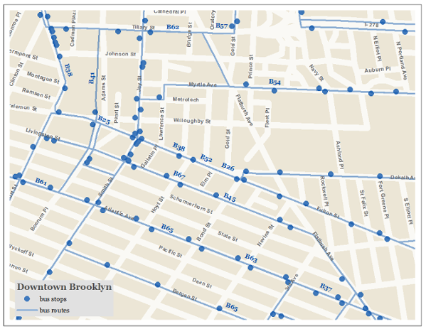
Sample Maps Created Using the Layers
Bus
Mass Transit dataset creation scripts on GitHub
Bus
Layers for Nov 2020 capture the resumption of normal services (compared to reduced services during May 2020 due to COVID-19). See this document for detailsPLEASE NOTE - each borough file may include, or may be missing, routes and stops for buses that originate in a neighboring borough.
| Date | Name | Features | File Type | Download | Metadata | |||||||
|---|---|---|---|---|---|---|---|---|---|---|---|---|
| 2016 2020 - MayNov | Brooklyn NYC Bus Routes | lines | shapefile | bus_routes_ | bknyc_ | bus_may2016nov2020.zip | XML | / PDF2016 | ||||
2020 - MayNov | Brooklyn NYC Bus Stops | points | shapefile | bus_stops_ | bknyc_ | bus_may2016nov2020.zip | XML | / PDF2016 | ||||
2020 - MayNov | Bronx NYC Express Bus Routes | lines | shapefile | express_bus_routes_ | bxnyc_ | bus_may2016nov2020.zip | XML | / PDF2016 | ||||
2020 - MayNov | Bronx NYC Express Bus Stops | points | shapefile | stopsexpress_ | bx_bus_ | may2016.zipXML / PDF | 2016 - May | Manhattan Bus Routes | lines | shapefile | routes_mn_bus_may2016stops_nyc_nov2020.zip | XML | / PDF
| 2016 - May | Manhattan Bus Stops | points | shapefile | stops_mn_bus_may2016.zip | XML / PDF | |||||||
Rail
| Date | Name | Features | File Type | Download | Metadata | ||||||
|---|---|---|---|---|---|---|---|---|---|---|---|
| 2019 - May | LIRR | 2016 - May | Eastern Queens Bus Routes | lines | shapefile | routes_qnlirr_bus_may2016may2019.zip | XML / PDF | ||||
| 2016 2019 - May | Eastern Queens Bus LIRR Stops | points | shapefile | stops_qnlirr_bus_may2016may2019.zip | XML / PDF | ||||||
| 2016 2019 - May | Staten Island Bus Metro-North Routes | lines | shapefile | routes_simetro_busnorth_may2016may2019.zip | XML / PDF | ||||||
| 2016 2019 - May | Staten Island Bus Metro-North Stops | points | shapefile | stops_simetro_busnorth_may2016may2019.zip | XML / PDF | ||||||
| 2016 2019 - May | Western Queens and Bus Company Routes | lines | shapefile | routes_bus_company_may2016.zip | XML / PDF | 2016 - May | Western Queens and Bus Company Metro-North Bronx Shuttle Bus Stops | points | shapefile | stopsmetro_north_bx_bus_company_may2016.zipmay2019 | XML / PDF |
Rail
Subway
Layers for Nov 2020 capture the resumption of normal services (compared to reduced services during May 2020 due to COVID-19). See this document for detailsPLEASE NOTE - the route file for Metro North is highly generalized and is not appropriate for detailed reference mapping at or below the county level.
| Date | Name | Features | File Type | Download | Metadata | |||||
|---|---|---|---|---|---|---|---|---|---|---|
| 2016 2020 - MayNov | LIRRSubway Routes | lines | shapefile | routes_ | lirrnyc_subway_ | may2016nov2020.zip | XML | / PDF2016 | ||
| 2020 - MayNov | LIRRSubway Stops | points | shapefile | stops_ | lirrnyc_subway_ | may2016nov2020.zip | XML | / PDF|||
| 2016 - May | Metro-North Routes | Subway Station Entrances | pointslines | shapefile | routessubway_metroentrances_north_may2016.zip | XML / PDF | ||||
| 2016 2017 - May | Metro-North Stops | pointsJan | PATH Train Routes | lines | shapefile | stopsroutes_ | metropath_ | north_may20162017.zip | XML | / PDF2016 |
| 2017 - May | Metro-North Bronx Shuttle BusJan | PATH Train Stops | points | shapefile | stops_ | metro_north_bxbus_may2016path_2017.zip | XML | / PDF
...
Annual Ridership
| Date | NameFeatures | File Type | Download | Metadata | ||
|---|---|---|---|---|---|---|
| 2020 - | MayAug | Subway Routes | lines | shapefile | routes_nyc_subway_may2016.zip | XML / PDF |
| 2016 - May | Subway Stops | points | shapefile | stops_nyc_subway_may2016.zip | XML / PDF | |
| 2016 - May | Subway Station Entrances | points | shapefile | entrances_nyc_subway_may2016.zip | XML / PDF |
| NYC Transit Subway Ridership 2007 to 2019 | excel | nycsubway_ridership.xlsx | see file for details | |
| 2020 - May | PATH Train Ridership 2012 to 2019 | excel | path_ridership.xlsx | see file for details |
![]()
Disclaimer: Every effort was made to insure that the data, which was compiled from public sources, was processed accurately. The creator, Baruch College, and CUNY disclaim any liability for errors, inaccuracies, or omissions that may be contained therein or for any damages that may arise from the foregoing. Users should independently verify the accuracy of the data for their purposes.
The Metropolitan Transportation Authority (MTA) has and the Port Authority of NY and NJ have not created nor do they endorse the datasets provided on this site. However, as the data was Data derived from MTA sources it is subject to the terms and conditions presented here: http://web.mta.info/developers/developer-data-terms.html#data.
...